After leaving Moab, we headed for the fourth of the five Utah National Parks. Capitol Reef was an unknown for both of us, so we had no expectations. What we discovered was a real hidden gem. This park isn't nearly as well-known as the other Utah parks, but it is slowly becoming more recognized.
 |
| Sunset at our BLM campground |
The day we arrived, the campground was full. The ranger directed us to a Bureau of Land Management (BLM) area just down the road. This is federal land that is designated for dry camping (no hook-ups or facilities) at no cost. You're basically parking your RV or tent in an unmaintained area off the road.
The ranger told us to come back in the morning for an available spot, which we did, and we were lucky enough to get one. If you look closely, you can see our RV in this photo. It's in the first row, second from the right.
The Visitor Center and campground are located in the Fruita Historic District. This fertile area along the Fremont River was settled by the Mormons in the 1880s. They planted apple, peach, cherry, pear, plum, apricot, and almond trees. Hence the name Fruita!
From our campground, we had beautiful views of Capitol Reef, the orchards, the barn, and the surrounding area. We were lucky enough to arrive when the cottonwoods, ashes, and fruit trees were in peak fall color.

 |
| Capital Reef in evening light |
Every morning, like clockwork, the wild turkeys would stroll through the campground. Sometimes picking up a fallen apple from one of the trees.

The deer were ever-present during the day, coming and going as they pleased. They would leap over the fence right behind our campsite and graze in the field around the barn in the evening.

There were several good hiking trails. On our first day, we hiked the Cohab Canyon trail that started from the campground. It is called a hanging canyon because it is in the mountain above the valley floor. You can see from the map that the first section of the hike was straight up the side of the mountain. Once at the top, the trail takes you through the canyon.
Here are some scenes along the trail.


 |
| Thank goodness for the cairns! |
 |
| View from the South Overlook |

From the Visitor Center there is a scenic drive through the park. It starts out as a paved road but becomes unpaved after a few miles. It takes you along the reef and through high canyon walls.

At the end of the road, there is a hiking trail through Capitol Gorge. Along one portion of the trail, some of the original Mormon settlers scratched their names on the side of the cliff wall. The names and dates still appear today.

One evening, we were treated to a guest speaker, Greg Owens, who presented a program on photographing the night sky. After an informative talk and slide presentation of his photos, Greg spent some practice time with those of us who had our cameras and tripods. That night was trial and error for me, but I had an opportunity to practice more at a later time and I hope to do more when I get to the desert.
 |
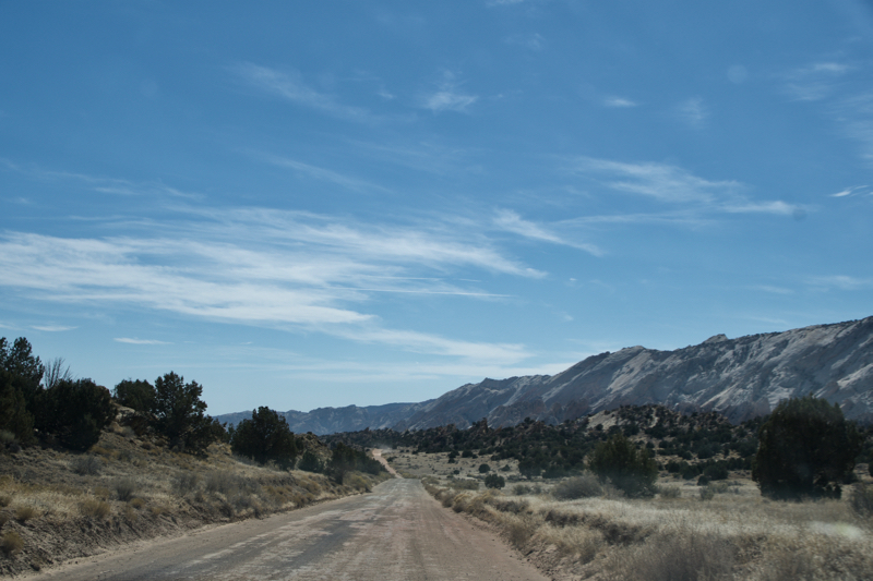
| A 30-mile unpaved washboard |
The next morning over coffee, Greg told Lee and I about a road to a remote part of the park that he said was a "must do" drive. So we decided to take his suggestion. We didn't know what we were in for!

At the end of the road we came to this. Just the word "switchbacks" makes me nervous.
We made it to the top! I took a picture of the sign at the top to show what we just climbed. There was no way we were going back down that way.
 |
| View from the top of the switchbacks |

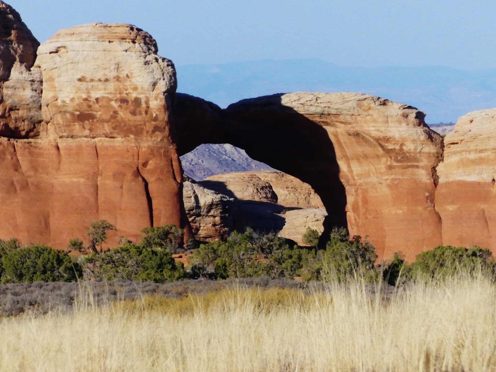
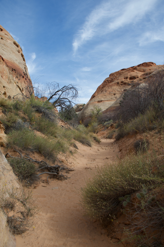
Fortunately, we found an alternate route back to the campground. It turns out, the route took us through Grand Staircase Escalante National Monument. Beautiful scenery, a red rock canyon and a few surprises along the way, including a slot canyon and an arch.
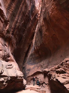 |
| Inside the slot canyon |
 |
| Entrance to a slot canyon |
Four down and one more Utah National Park to go. On to Zion next!
 After leaving Moab, we headed for the fourth of the five Utah National Parks. Capitol Reef was an unknown for both of us, so we had no expectations. What we discovered was a real hidden gem. This park isn't nearly as well-known as the other Utah parks, but it is slowly becoming more recognized.


 There were several good hiking trails. On our first day, we hiked the Cohab Canyon trail that started from the campground. It is called a hanging canyon because it is in the mountain above the valley floor. You can see from the map that the first section of the hike was straight up the side of the mountain. Once at the top, the trail takes you through the canyon.


 From the Visitor Center there is a scenic drive through the park. It starts out as a paved road but becomes unpaved after a few miles. It takes you along the reef and through high canyon walls.


 At the end of the road we came to this. Just the word "switchbacks" makes me nervous.

 Fortunately, we found an alternate route back to the campground. It turns out, the route took us through Grand Staircase Escalante National Monument. Beautiful scenery, a red rock canyon and a few surprises along the way, including a slot canyon and an arch.