Wednesday, August 20, 2014

Idaho and Craters of the Moon National Monument

When we left Bend, OR we were in a quandary as to going home or continue sightseeing.  After a hot night in Caldwell, ID (with no A/C) and after looking at the (cooler) forecast for Arco, ID we decided to head for Craters of the Moon National Monument. Boy am I glad we did!
Craters of the Moon NM covers 750,000 acres of lava flows, cinder cones, craters and lava tube caves. There's a 7 mile loop road leading to all the sights that is suitable for cycling and running although you'll have to do those things at 6000'.

 Our campground is in the middle of this pic surrounded by cinders, lava rocks and craters.
Our front porch with a cinder floor and lava rock gardens.


Our "wheel estate"
While there we each decided to navigate the park loop road via our favorite conveyance.

Lynda ran...


...and I rode. It was tough going considering the altitude.


Yep, 750,000 acres of ah ah and pahoihoi lava. What? ah ah and pahoihoi? Volcanologists studied active volcanos in Hawaii and brought back the Hawaiian words for certain types of lava.


Cinder and spatter cones dotted the landscape.


On the edges of the spatter cones the rock looked like liquid plastic.


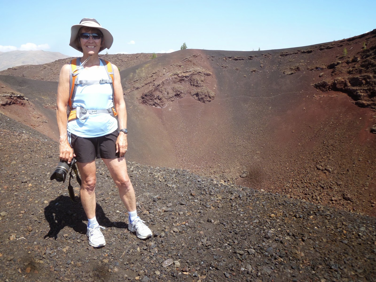
We climbed to the top of one of the craters which was several hundred yards wide and several hundred feet deep.


Don't Back Up!


We did a ranger hike into Indian tunnel which is a lava tube cave. In several spots the roof had caved in letting in plenty of light.


We walked through the cave and had to come up out of a small hole on the other end. Hi Lynda!


And then find our way back to the entrance!


 At Boy Scout Cave I decided to venture in. On the surface it was in the high 80s, just a few feet into the cave the temp dropped into the 50s and there was ice on the floor of the cave.
Also, there hadn't been any roof collapses here so it was pitch black inside.


I'm not crazy about small spaces and was pleasantly surprised by the room inside the cave. Even so, I was glad to be out!


All good things must eventually come to an end so we bid farewell to Craters of the Moon with a pretty sunset and subsequent full moon.


Wednesday, August 13, 2014

Bend Oregon and Volcanoes (Who knew?)

We (believe it or not) turned EAST and headed to Bend to visit some friends we met in Alaska and our son-in-law's parents.
We headed east on Rt. 20 which is boring at times but eventually reaches the beautiful Williamette National Forest.


The road is twisty turney, up and down and quite narrow in spots but goes through a green tunnel of enormous firs for 20 or 30 miles. Beautiful!
There are also places where fires have left all but a few trees scarred and barren. In the distance is Mt. Washington (Oregon not New Hampshire)


We found this pretty pond among the devastation.


After settling in at our campground in Bend we met our Alaska friends Tonya and Cort for dinner at   the Worthy Brew Pub. They told us about places to visit including the Newberry National Volcanic Monument.
The next morning we took a ride south. The park consists of several sections, Lava Land, Lava Caves, the Tree Cast Forest and Newberry Crater. Newberry Crater is in the Deschutes National Forest where you can see the Obsidian Flow and Paulina Peak which overlooks Paulina Lake and East Lake.


At Lava Land you can drive to the top of the 500' tall cinder cone called Lava Butte.


Lava Butte looks out over a lava field toward Mt. Bachelor.


  The cinder cone's crater is about 150' deep.


Next we went to Newberry Volcanic National Monument to walk on the Obsidian Flow. Obsidian is black volcanic glass that Native Americans used for arrowheads, knives and scrapers. Obsidian can be fashioned to an edge 1 molecule thick which gives it an edge sharper than a steel scalpel.


This path took us through the a very small portion of 750 acre Obsidian flow. There is a large piece of obsidian to the left center of this pic.


This is a wall that looks like black brick but is black volcanic glass.


 A closeup of a piece of obsidian.


The Obsidian Flow from Paulina Peak with Paulina Lake in the background.


7935' Paulina Peak from the Obsidian Flow.


Next we drove the 4 mile gravel road up to the peak. The road had such bad washboard I had to use 4 wheel drive. I don't know how people made it up in cars, but they were at the top!


Of course we had to "hike" all of a hundred feet from the parking lot to the peak to take a selfie! Paulina Lake is behind us and we think Mt. Hood is to the left.


The Tree Cast Forest is a lava flow where molten lava moved through a forest. The trees were trapped in lava that eventually cooled and hardened. As the tree burned, or over time rotted away, a "cast" of the tree was all that was left.


The resulting casts look like this


 Next up: The moon


Tuesday, August 12, 2014

The Oregon Coast

After a fun week in Kent, WA with Laura and Chris, we headed south to Oregon. We crossed into Oregon in Astoria where the mouth of the Columbia River meets the Pacific Ocean.


Haystack Rock 
The Oregon coast is known for its beautiful beaches with large outcroppings of rock along the shore. We stopped at a few viewpoints on our way to our campground. Here are a few samples of what we saw. Haystack Rock in Cannon Beach is most recognizable.


In case you forgot what we look like, we posed at the overlook above!


We arrived at our campground which was located on the bay at Rockaway Beach. This was our view from behind our trailer.


After getting settled, we drove over to Rockaway Beach to take a stroll. It was a cool day, and the water in the Pacific is much colder than the Atlantic, so you don't usually see swimmers.


Back at the campground, we watched the gulls feeding on what the fishermen left behind on the dock as the sun was setting.


The next day, we continued down the coast passing more beautiful scenery on our way to Newport Beach.


We were lucky to get a campsite at South Beach State Park in Newport for two nights. It's a large wooded park with paved paths that lead through grassy dunes to the beach.


From the dunes, we could see the bridge that we crossed to get to the campground. Newport is on both sides of the bridge.


We took our mountain bikes out for a ride and came upon this sign. Good to know, but we sure hoped we wouldn't need to use this information!


Our ride took us down to the harbor where we crossed the bridge the day before.


Lee is looking for the sea lions that we can hear barking from here. He also is looking to see if he can find the brew pub! We found the Rogue Brewery, but they have a pub across the harbor.


Meanwhile, I was photographing the birds in and around the bridge.  The osprey made a nest on what appeared to be the tsunami warning siren post. The two birds were standing guard against an attack by gulls. I couldn't see if there were eggs or chicks inside.

The cormorants were all over the underside of the bridge.


That night we found the Rogue Brew Pub. We enjoyed one of their local brews and a game of Jenga while waiting for our order of fish & chips.


After dinner we walked across the street along the dock, following the barking sound until we found the source. Sea lions filled the dock.

A sea lion pup sleeping through all the noise!


In the morning, we left the coast and headed east for the first time in three months! Our next stop, Bend, Oregon.