Wednesday, June 11, 2014

Whitehorse, Carcross and Miles Canyon

Whitehorse, capital of the Yukon Territory sits in a valley astride the Yukon River. Two thirds of the Yukon's population live in or around Whitehorse  The city is noted as having the least air pollution in the world.

The busy downtown area is attractive and well laid out.


We got in late and decided to have dinner in town. We asked for a recommendation from some fellow RV'ers and were directed to a pub in town. As luck would have it we found the street and location but went in the wrong door and ended up in a pizza/beer joint. We wanted burgers but lucked into Yukon Brewing Co. (Whitehorse) beer and a bison chorizo, grilled onion and pepperocini pizza. Yum! Some wrong turns work out for the best.


At the top of Two Mile Hill, the western exit of town, is a sculpture of  a horse collaborated on by a local sculptor and local welder. It's made up of scrap wires, cables, tools, appliances, wheels, gears, etc., etc.  At right, below, the lower leg is a 12" sizing plane.


The horse sculpture is behind the fire department headquarters along with this unique "Fireman" complete with turnout gear and hose.  All the components of the "fireman" are used fire extinguishing gear, extinguishers, spray heads, regulators, etc. It even has footprints on the concrete base!


Later in the day we took a ride to Miles Canyon to see where the Whitehorse Rapids had once terrorized river travelers trying to get to the Klondike gold fields. The rapids were so dangerous that eventually only qualified boatmen were allowed to transport passengers and cargo. The Yukon was later dammed for hydroelectric power so the rapids no longer exist but the remaining canyon is beautiful.


There's a suspension bridge across the river for access to hiking/mountain biking trails.


These bridges are not Lynda's favorite places to be but...


...she was OK as long as I didn't make the bridge sway.


Another of Lynda's favorite activities is hiking a narrow trail along a cliff, NOT! It's about a 50' drop into the frigid Yukon. (We found mountain bike tire tracks on this trail. Yikes!)


The next day we took a ride toward Skagway and stopped in Carcross. Carcross' claims to fame are The Carcross Desert, also known as "The World's Smallest Desert", and the narrow gauge White Pass and Yukon Railroad. It was also a trade center for the Tlingit and Tagish Nations as well as a terminus of the Chilkoot Trail which brought gold seekers from Skagway.

The Carcross Desert is actually a series of dunes deposited in the area after the last Ice Age. Presently, prevailing winds off of Bennett Lake blow sand into the dunes replenishing them.

The locals use the dunes for sandboarding and, unfortunately, ATVing.

This Caribou welcomes you to Carcross, originally known as Caribou Crossing, until a Post Office screw up.


The Matthew Watson General Store is one of the original businesses/stores in town.

The train station serves passengers riding on the White Pass and Yukon Railroad going to Skagway or Whitehorse.

The old steel girder bridge takes the train over the river between Bennett Lake and Tagish Lake.


Emerald Lake is one of the incredibly green lakes along the road to Carcross.


Tuesday, June 10, 2014

The Alaska Highway part 2 of... probably 2

We're presently in Tok, Alaska after a rough 290 miles from Haines Junction on the Alaska Highway. The nasty AH that travelers hear about from the time they start planning their trip reared it's ugly head today. This section is built across tundra and permafrost that develops huge ruts and frost heaves every year. They say there's two seasons on this section, winter and construction.

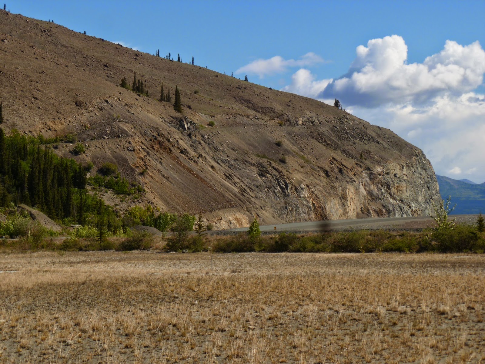
This is a pic of the old and the new highway with the new one cut into the mountain face along Kluane Lake and the old one snaking it's way around the mountain about half way up. We hiked part of the old road to Soldiers Summit where the northern and southern sections of the AH met and the road was opened for business. I wouldn't want to drive my "Off Road 4WD" truck over that road!


After the nice section around Kluane Lake we started to hit some of the "redone" gravel sections. This was not bad compared to the next 80 miles of rutted roller coaster. I felt like I was in a small boat in a hurricane. Top speed, about 50 kph (oops, 30 mph).


...and then... the dreaded, red light... in the middle of nowhere.


We waited 10-15 minutes for the pilot car to lead 10 of us through the 13 km construction zone. They were laying down a subsurface material of crushed rock and gravel and then wetting it to keep down dust. This just created, yes, mud! Mud that ended up covering everything. Every business in Tok has an RV wash that must make a fortune!


If you look closely, above the pilot car, you'll see a motorhome broken down in the middle of the construction zone. The nearest help is at least 80 miles away. Yikes!


 80 miles later, Alaska, USA!
Finally, the bridge into Tok, AK


I had to edit this post to add a pic of this message on a hill on the AH.

Mom, this is for you!
 

We made it through mud covered but with none of the damage other travelers have experienced.
I put this up before posts of some of the places we visited along the Alaska Highway but we'll catch up eventually.
That's all for now but, stay tuned, there's more to come!


Thursday, June 5, 2014

Watson Lake and The Signpost Forest

After a beautiful camping spot in Liard Hot Springs Provincial Park we headed up the road to Watson Lake, our first destination in the Yukon and home to The Signpost Forest.

While recovering from an injury which occurred during construction of the Alaska Highway Pvt. Carl Lindley was asked to repair a damaged army signpost. He was homesick so he added a sign with mileage to his hometown of Danville, Illinois, thus was born a forest of signs that now numbers over 75,000.


 We, (I) was unprepared to make a sign for the forest, didn`t think about it during our pre-trip prep. Fortunately for us tourists, the local hardware store sold precut boards and the Visitors Center had paint and markers, so we were ready to make a sign. But, I needed some help, and two youngsters, Nicolas and Emma appeared. We met them at Liard Hot Springs and were surprised to see them at the forest. In the pic below, Nicolas is hamming it up for the camera while Emma checks my spelling.
Also, our new friend Ken Hunter showed up and said that a Dremel would make the job easier. I bet he had one and was right! Thanks Ken!
We worked on our sign for about 45 minutes while Nicolas and Emma's mom made a beautiful sign in about 10 minutes. We found out that she had taken fashion design in school so she could draw more than stick figures! Sounds like cheating to me.


Finally we were done and I was actually prepared to hang the sign (I remembered to bring along my screwgun) So here's our sign, hanging in The Signpost Forest, between the Visitors Center and the Alaska Highway.


Camping in British Columbia

June 4, 2014

Yay, we've got wifi again today, so once again, I'm playing catch-up. As Lee described in his last post, on May 28th we made it over the summit of Stone Mountain. As we descended, we spotted several stone sheep along the side of the road and up on the hillside. These sheep are indigenous to northern BC and southern YT. They're a little smaller than the big-horned sheep and are sometimes mistaken for mountain goats.


This female and her lamb were enjoying the salty taste of the stones along the roadside. Whenever a large truck passed by, they would run up the hill and return shortly after.


The male stone sheep's horns are larger than the female's. The larger the horns, the more status it has in the herd.


On our way to our campground, we passed a sign advertising the world's best cinnamon buns. It was at a place called Tetsa River Services and Campground. Of course, we had to stop! There was very little appeal to the campground, but we were only there for the buns! We went into the lodge and the aroma was wonderful. We were greeted by a very friendly baker who proceeded to warm up two buns for us. When they arrived, our eyes opened wide when we saw the size of them. They were huge and delicious! I'm so mad that we forgot to take a photo of them.

With our stomachs full, on we went to our destination for the evening...the Toad River Lodge campground in Toad River, BC. (Km 647 on the Alaska Highway) A very nice fellow traveler who we met at our last campground recommended it. After passing several campgrounds that day that looked very unappealing, it really was the best choice and we were glad we took his advice.


We were greeted by this sign as we pulled into the parking lot.

The lodge is famous for the collection of hats that are hanging on the ceiling. There must have been hundreds of them. Unfortunately, we didn't know about this ahead of time, or else Lee would have brought one to hang.


The campground was alongside a pond which ran into a large lake. Our campsite was next to the pond. There just so happened to be a beaver lodge in the center of the pond. What a great view we had.


We enjoyed watching the beaver work nonstop all afternoon.....


 .....and into the evening!


The phrase "busy as a beaver" is very accurate!


He finally climbed up on the dam to take a break and have a snack. That stick looks yummy!


Meanwhile, out on the lake, there were a variety of ducks and other waterfowl that were new to me. A fellow camper was out there photographing also and he helped me to identify them.

Lesser Scaup

American Widgeon

Not sure about this one. Maybe a female Scaup?


Horned Grebe

 It's mating season for the horned grebes, so there was a bit of rivalry going on among them. They'd come together in the lake and all of a sudden break out into a skirmish. Very funny to watch.


The next morning we continued north. Along the way, we passed Muncho Lake. "Muncho" means "big lake" in the Kaska language. It is 7.5 miles long. The Alaska Highway runs right along its shore. The word "highway" is hardly what I would use to describe this road.


At the northern end, the lake was still partially frozen. The green-blue color is caused by copper-oxide leaching into the lake. When the light is right, it really stands out. So many of the lakes in this region have this striking color.


We decided to make it a short driving day and stopped at Liard River Hotsprings Provincial Park. (Km764.7 on the Alaska Highway) This was the first time we stayed at a campground with no hook-ups. For the uninitiated, this is called "dry camping." These park campgrounds are generally the prettiest and most wooded. This one was no exception.


Between the hours of 9-11 am and 6-8 pm you are permitted to run your generator, so you can charge your phones, computers, etc. We have propane tanks for cooking and a holding tank for water. Okay, so we're not exactly roughing it!


It was a beautiful spot for a run, so Lee and I went out for a few miles. It felt good to stretch the legs. Then we headed for the hot springs.  From the campground, it was a short walk along a boardwalk through a marsh.


They lived up to their name! The temperature at the near end was too hot to go into right away. We started off in the far section. There's a small falls at the far end in this photo. Beyond that is another pool. The temp in that section was like a nice warm bath. It felt great on my sore back! After getting used to the temps, we were able to get into the warmer section. Not sure what the actual temp was, but it was at least 105 degrees F, probably more in the warmer section.


Farther north tomorrow!